


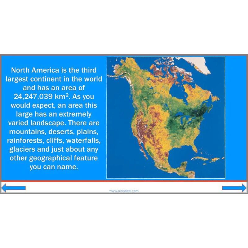


North America
Voyage across the Atlantic with your class as they discover the continent of North America and all its amazing countries, cities and landscapes with this North America KS2 planning pack for Year 5 and Year 6. Your class will identify the 23 countries of North America, from the vast lands of the USA and Canada down through Central America and on to the Caribbean islands. On the way they will explore the various geographical features of different areas of North America and compare them with their own locality.
Including a set of detailed lesson plans, informative slideshows for each lesson, differentiated activity ideas, and a range of colourful, engaging worksheets and other helpful printable resources, this 'North America' KS2 planning pack provide everything you need to teach your class about this fascinating and diverse continent – it's all ready for you to download, teach and enjoy with your Year 5 or Year 6 class.
You may also like our Yosemite National Park Geography scheme of work exploring the one of the oldest national parks in North America.
The Countries
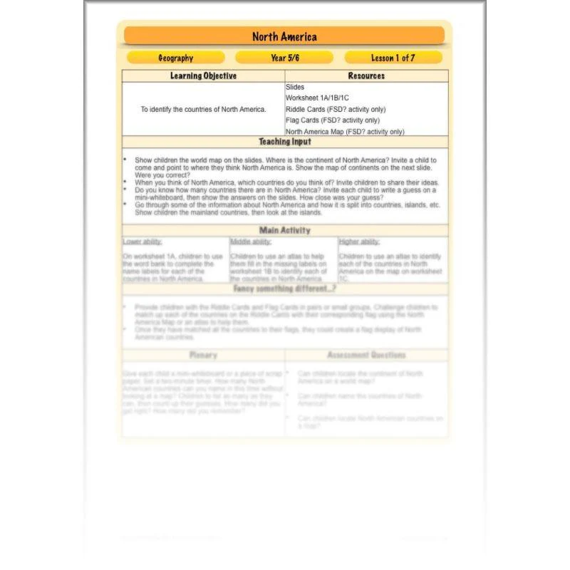
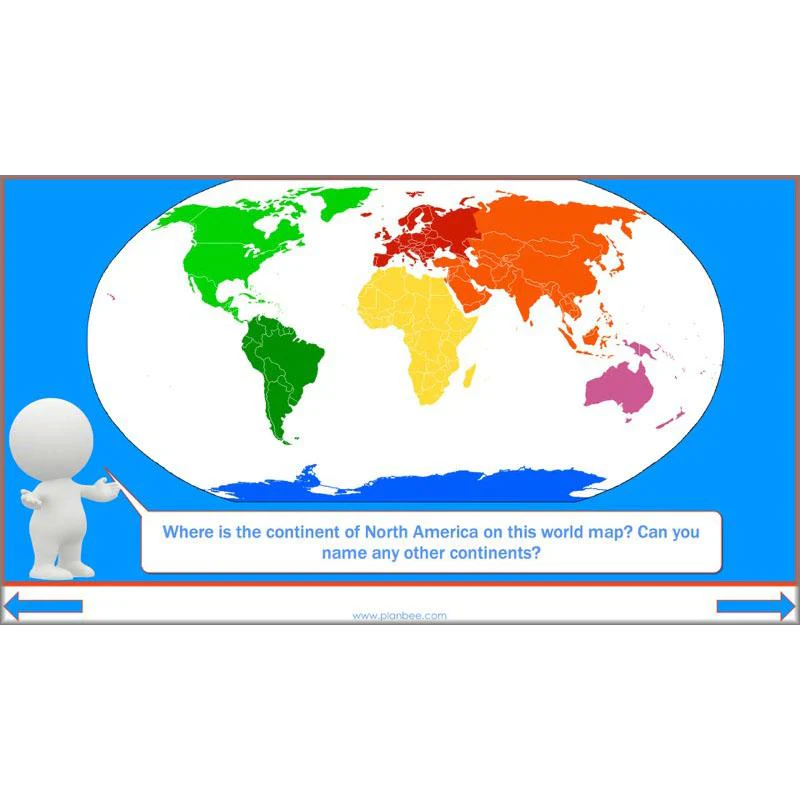
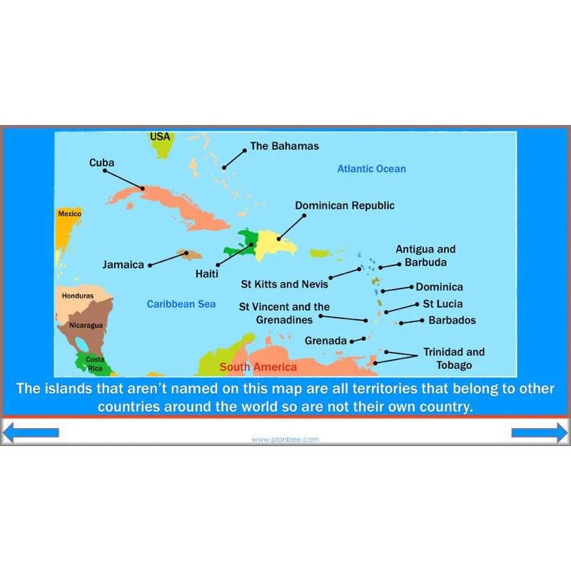
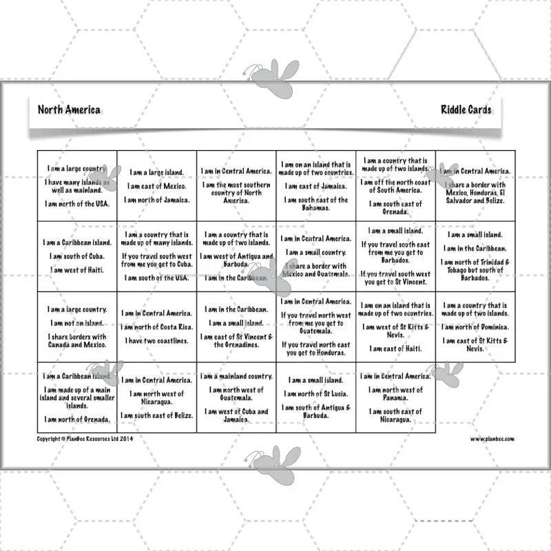
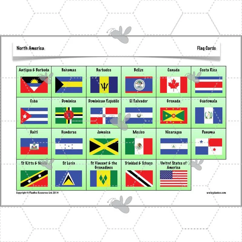
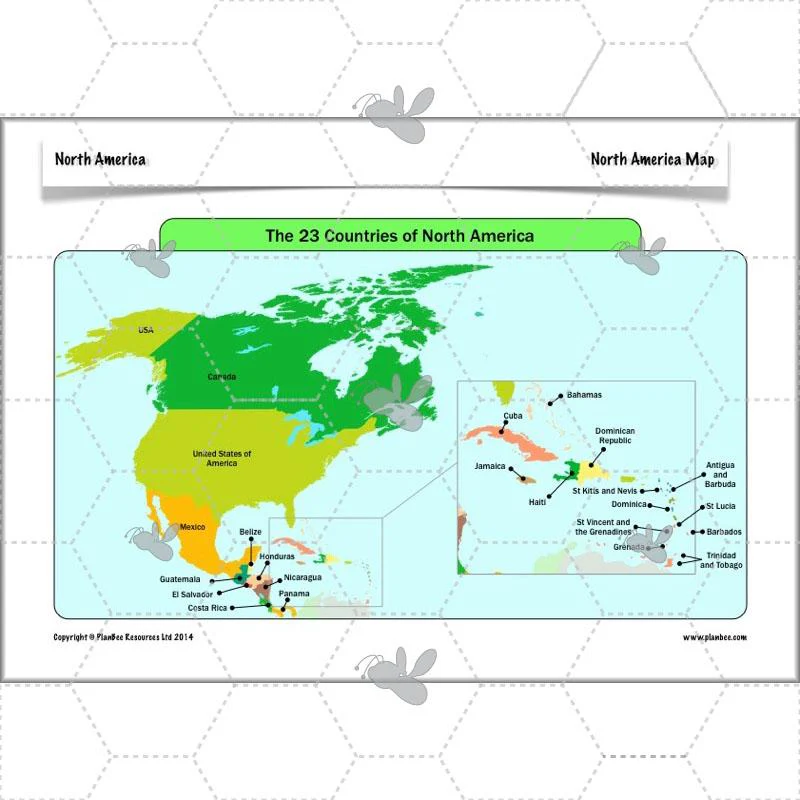
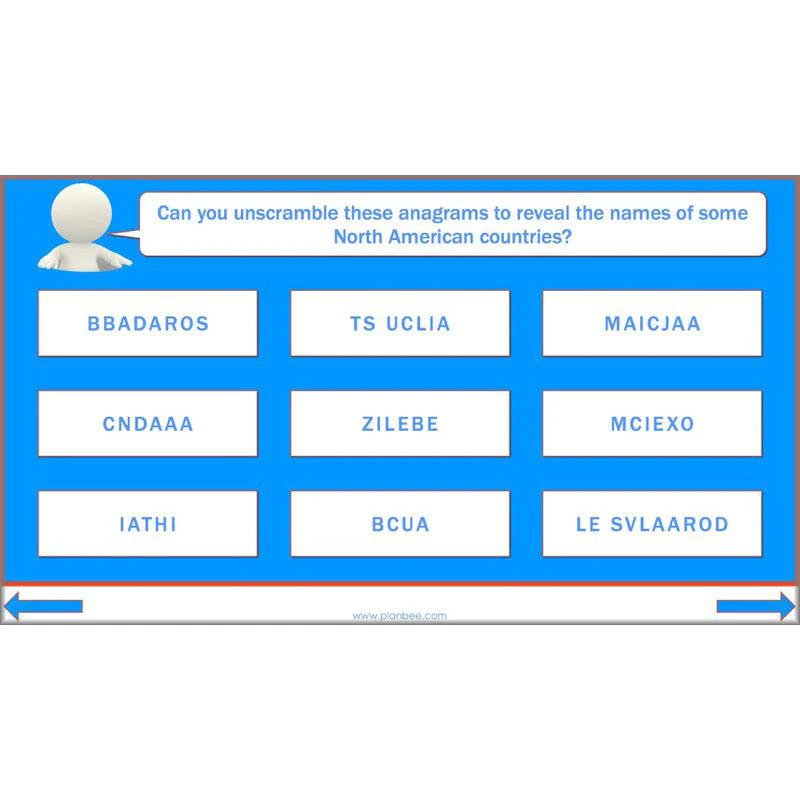
This Countries in North America KS2 lesson is the first lesson in the North America Geography Scheme of work. It starts by helping your children identify North America on a world map before identifying and locating the 23 countries of North America on a map. Your children will discover how North America is split into sections, including Central America and the Caribbean, before using their map skills to label each of the countries on a blank map. Alternatively they can solve some tricky riddles to identify each country!
This downloadable lesson comes with a lesson plan, slideshow presentation and printable teaching resources.
What's included:
- Lesson plan
- Slides
- Activity ideas
- Differentiated worksheets
- Riddle cards
- Flag cards
- North America map
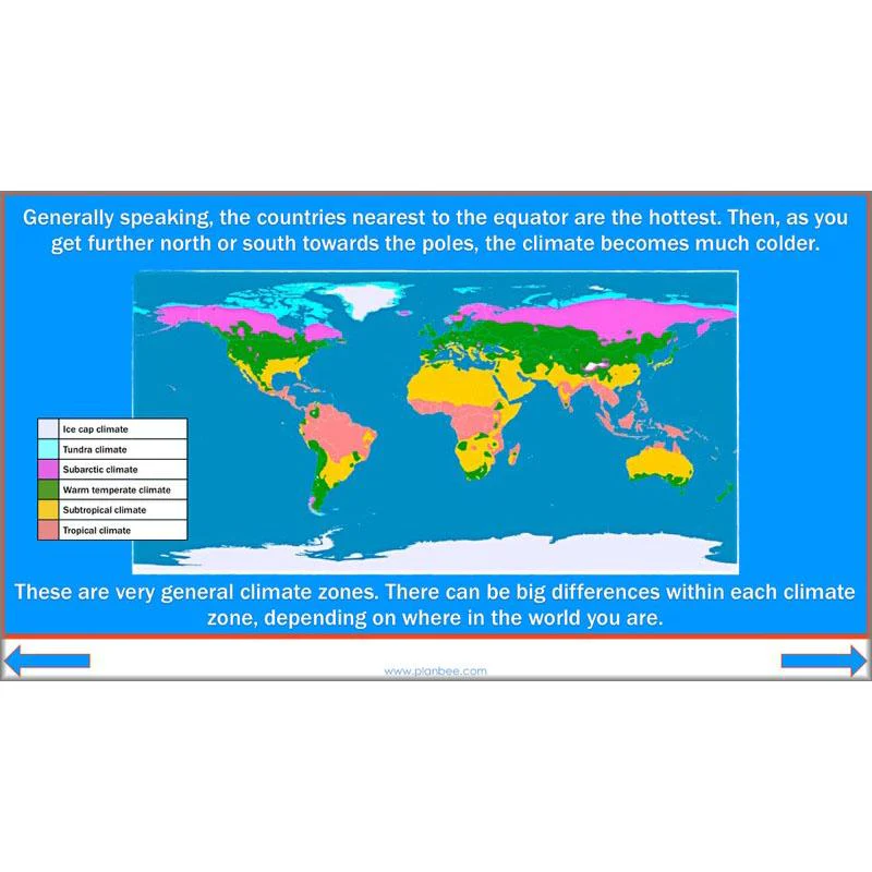
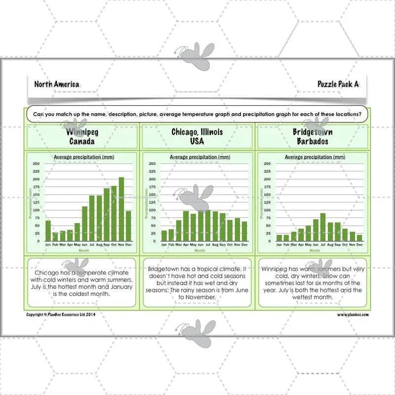
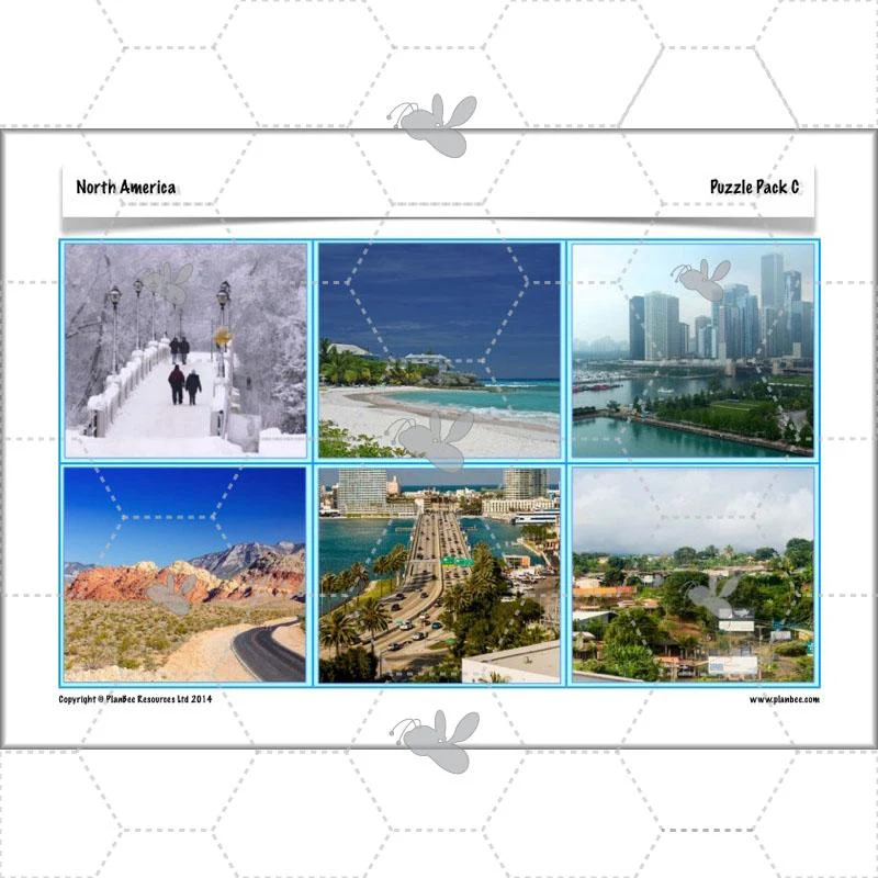
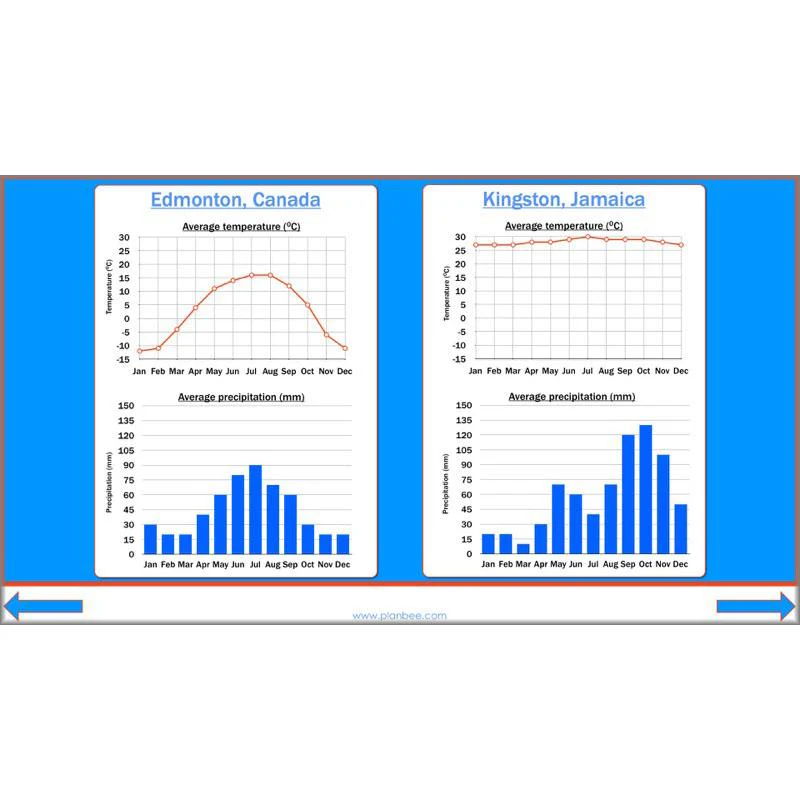
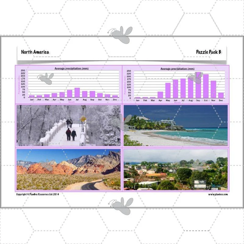
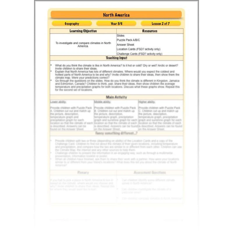
Climates
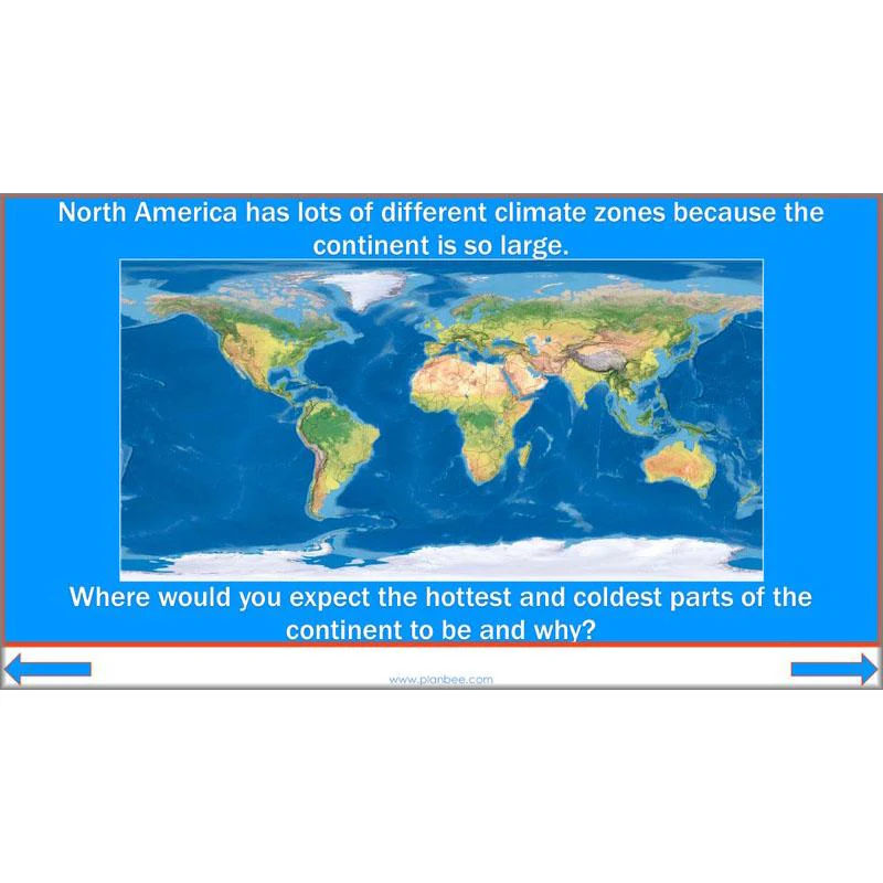
This Climate of North America lesson starts by identifying some different climate zones. Your class will look at a global climate map before exploring the various climate zones of North America in more detail. They will be challenged to match up various climate graphs to descriptions and pictures of a variety of North American locations, interpreting the graphs to identify which locations are being described. There is also the option to compare the climates of two or more North American locations in more detail.
This downloadable lesson comes with a lesson plan, slideshow presentation and printable teaching resources.
What's included:
- Lesson plan
- Slides
- Activity ideas
- Differentiated puzzle packs
- Answer sheet
- Location cards
- Challenge cards
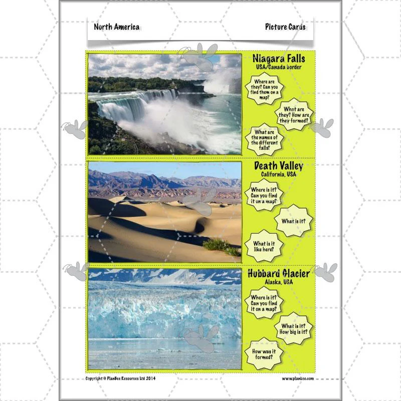
Features
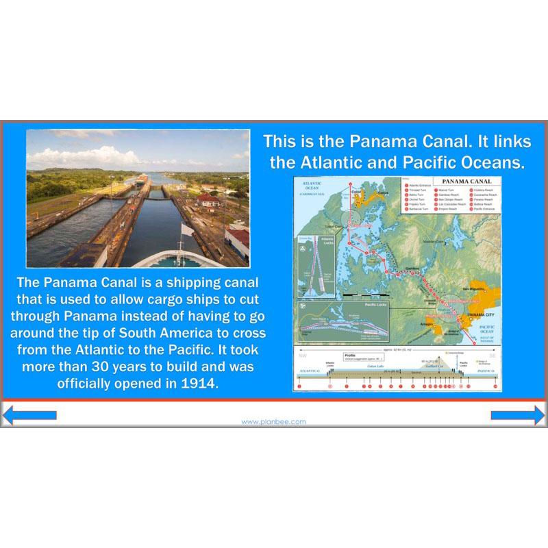
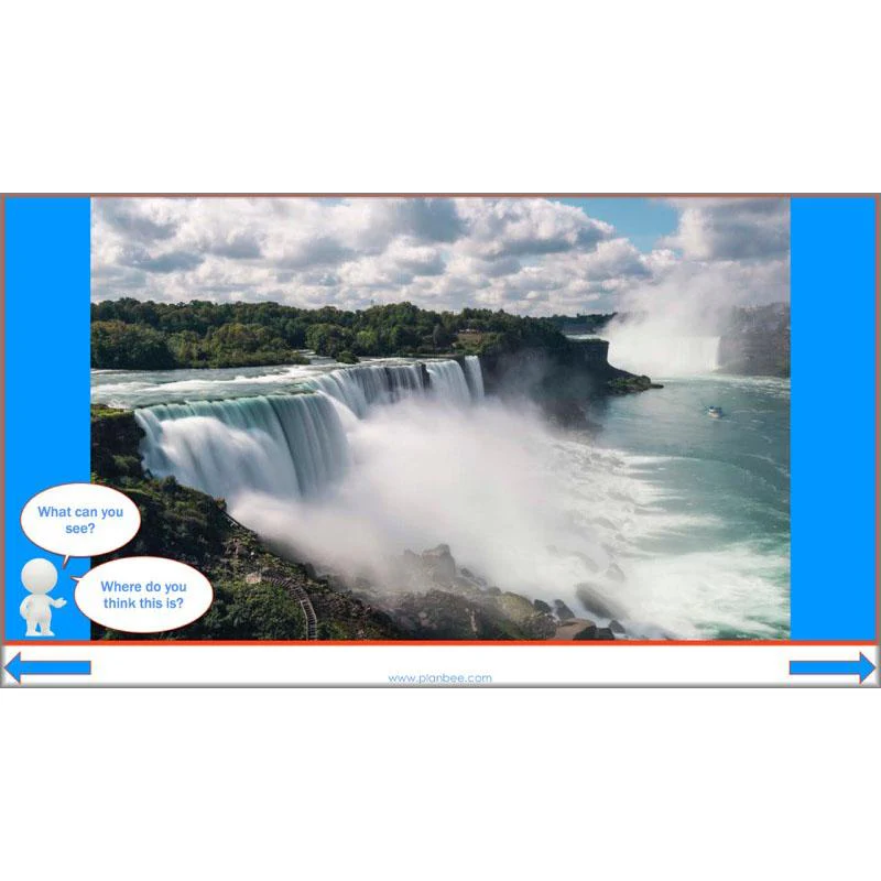
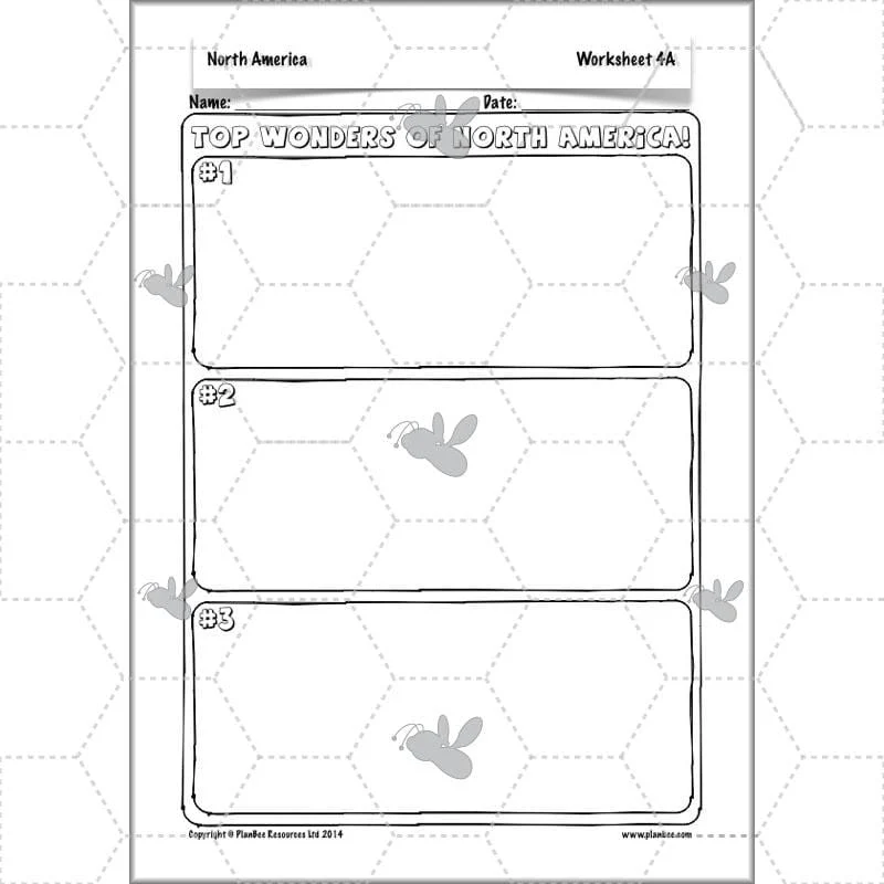
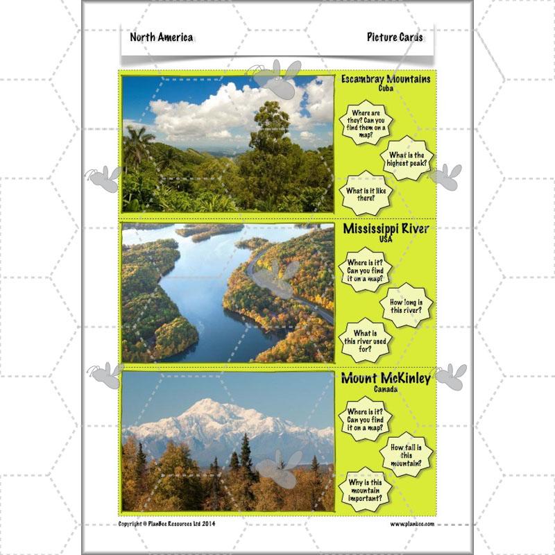
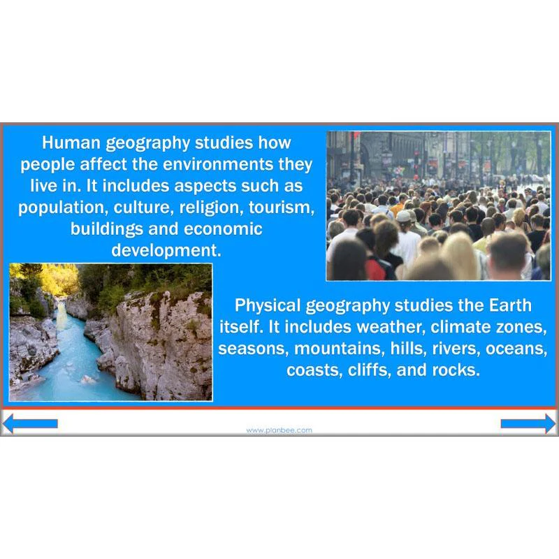
This interesting Human and Physical Geography of North America lesson gives your KS2 class a whistle-stop tour of some of the most amazing geographical features of North America, both natural and man-made. From the Grand Canyon to the Panama Canal, your class will investigate different features and consider how they came to be there. They can then compile a list of the top North American wonders!
This downloadable lesson contains a lesson plan, slideshow presentation and printable teaching resources.
What's included:
- Lesson plan
- Slides
- Activity ideas
- Differentiated worksheets
- Picture cards
- Information sheet
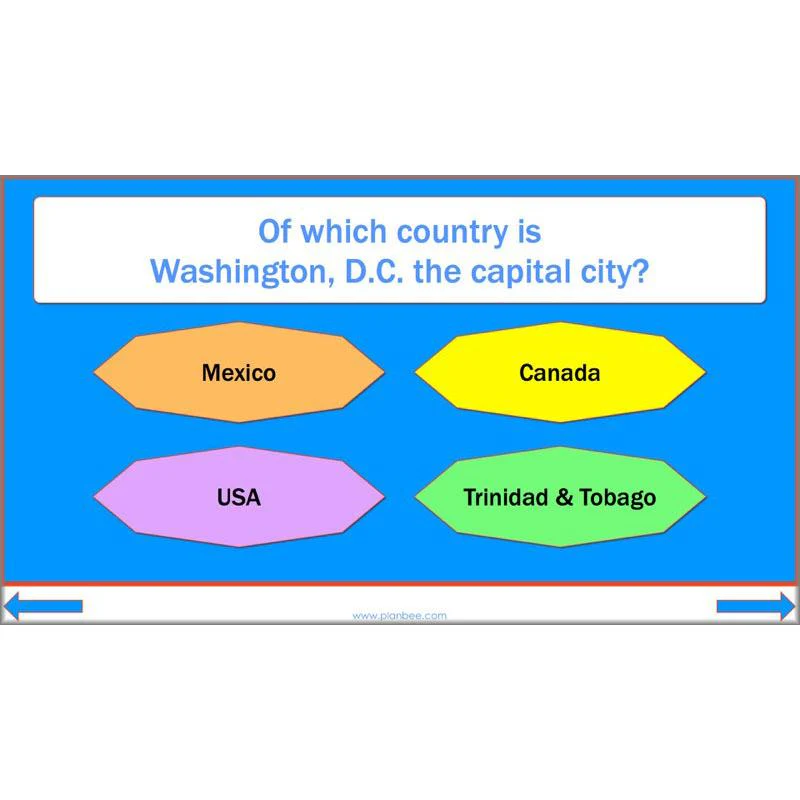
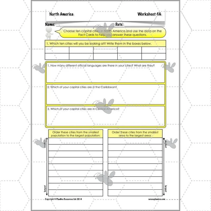
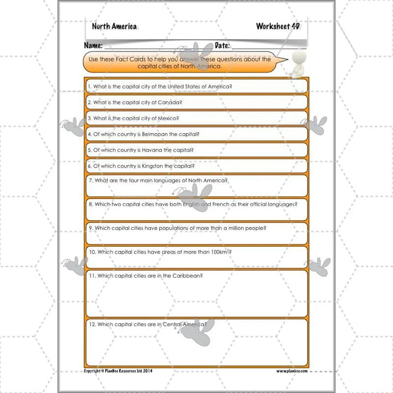
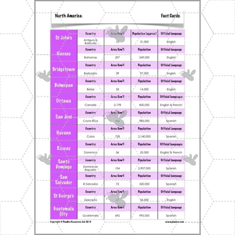
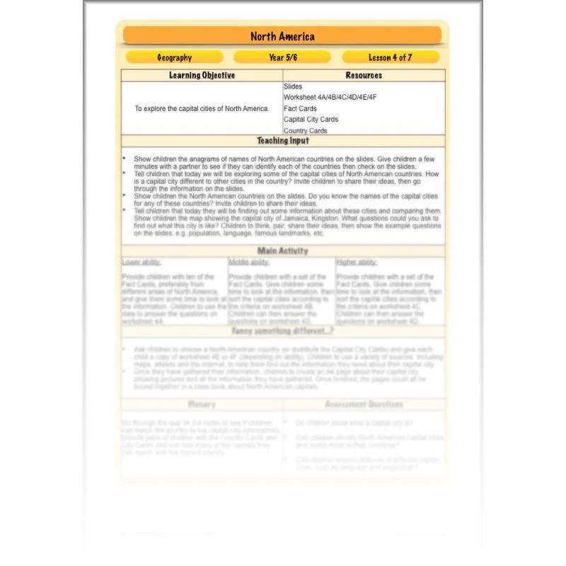
Capital Cities
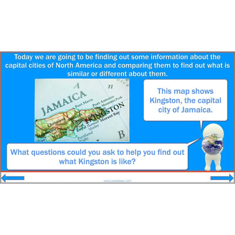
After a quick recap of the names of some North American countries, your children will investigate some of their capital cities. They will be challenged to think of questions they could ask to find out information about a particular city, such as the population, climate and language, before either comparing capital cities from the given Fact Cards or choosing one city to investigate for themselves.
This downloadable lesson comes complete with a lesson plan, slideshow presentation and printable teaching resources.
What's included:
- Lesson plan
- Slides
- Activity ideas
- Differentiated worksheets
- Fact cards
- Capital city cards
- Country cards
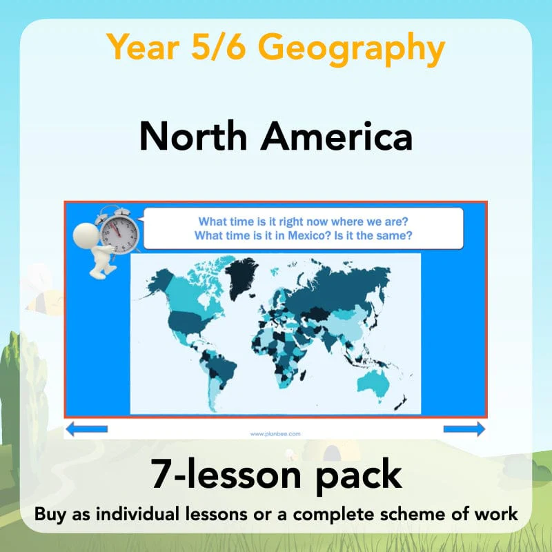
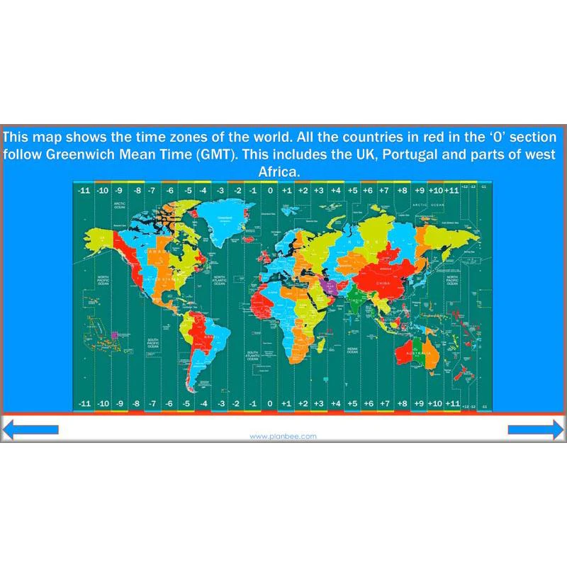
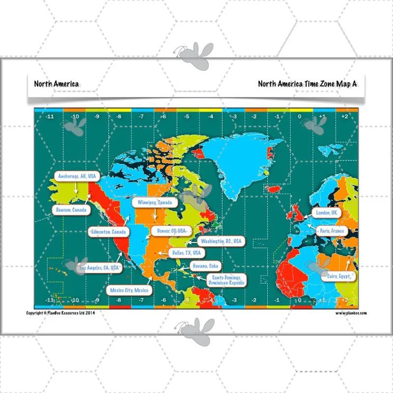
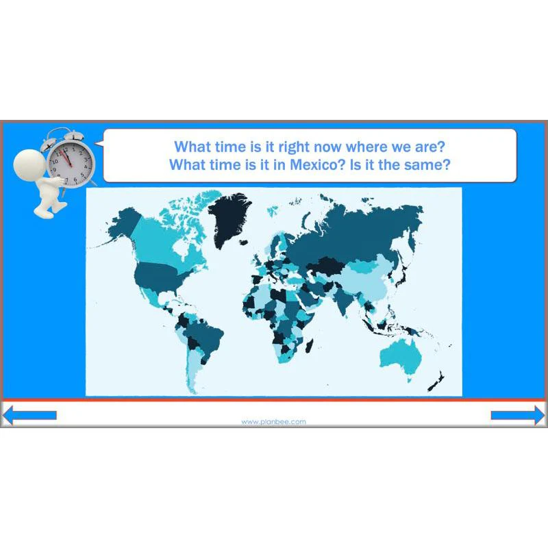
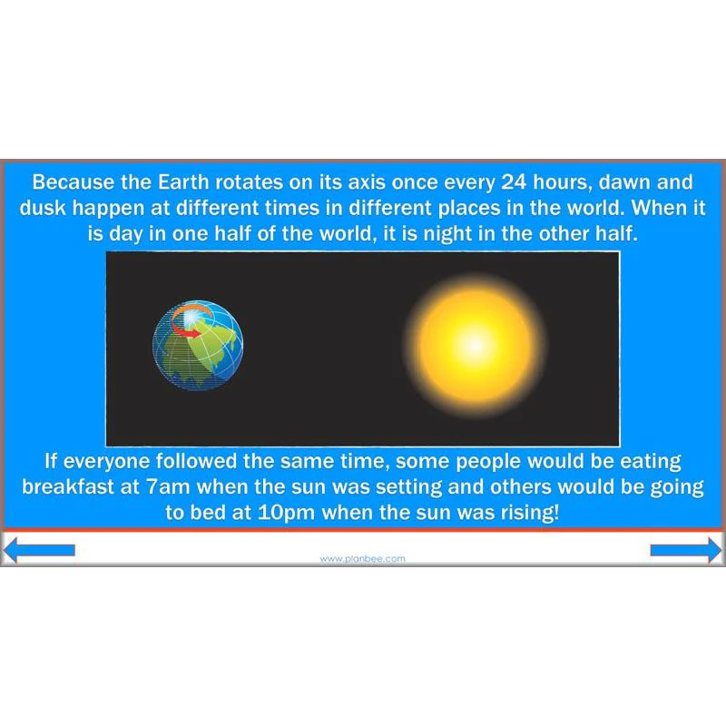
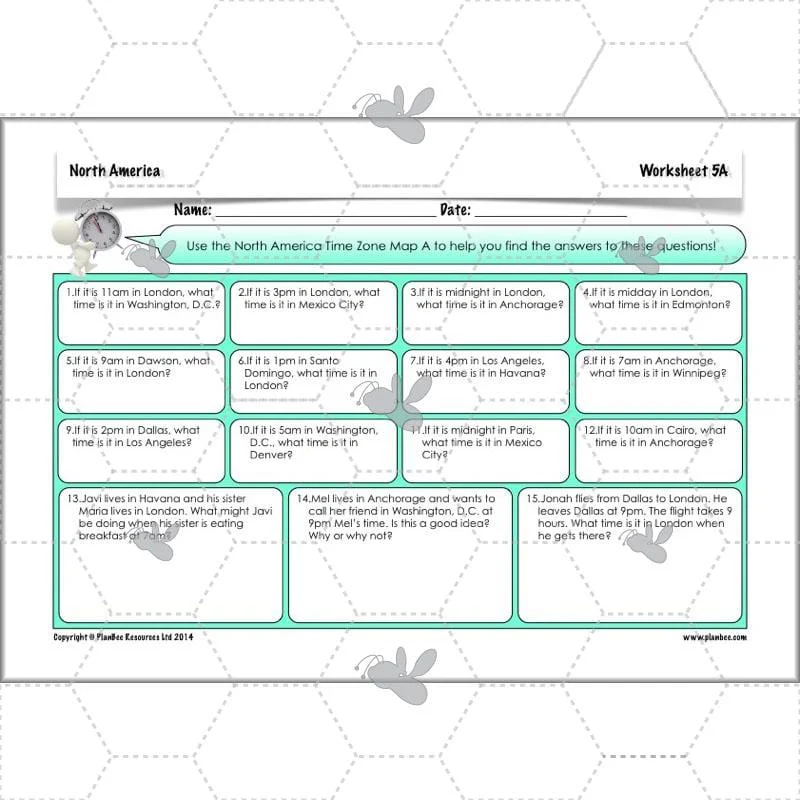
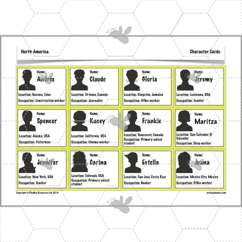
Time Zones
This fun North America Time Zones KS2 lesson introduces your class to the different time zones of the world. It focuses on North America and challenges your class to think about why we have time zones and what this means for people in different locations around the world. They will then be challenged to work out some time zone problems, such as what the time is in Washington, D.C. if it is 2pm in London.
This downloadable lesson contains a lesson plan. slideshow presentation and printable teaching resources.
What's included:
- Lesson plan
- Slides
- Activity ideas
- Differentiated worksheets
- Differentiated North America time zone maps
- World time zone map
- Character cards
- Time cards
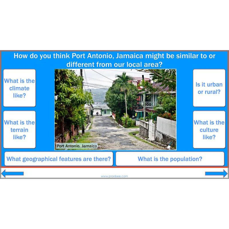
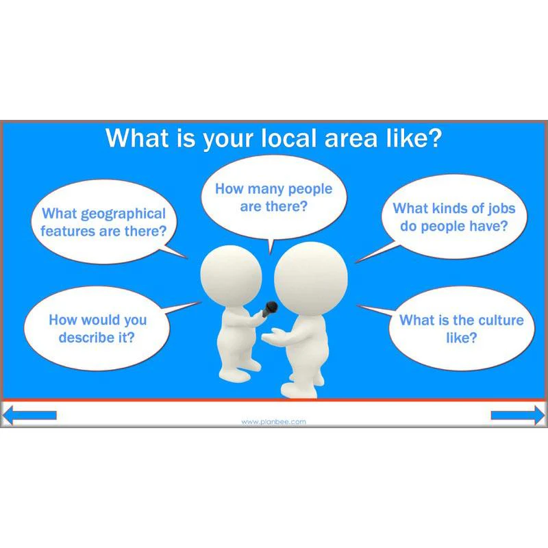
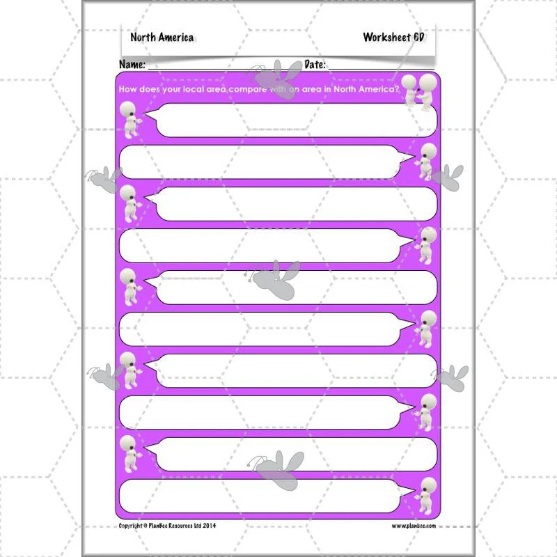
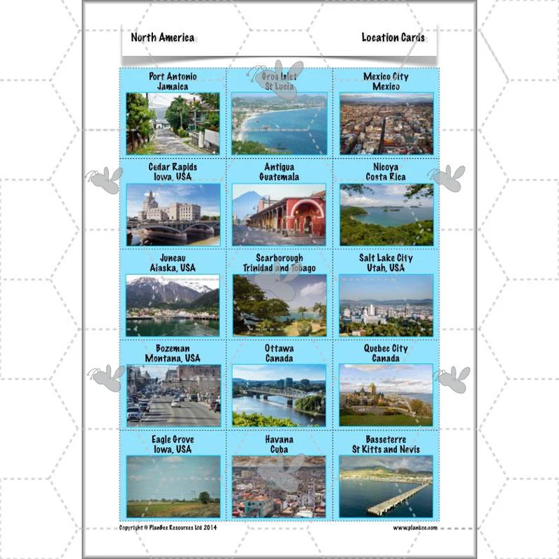
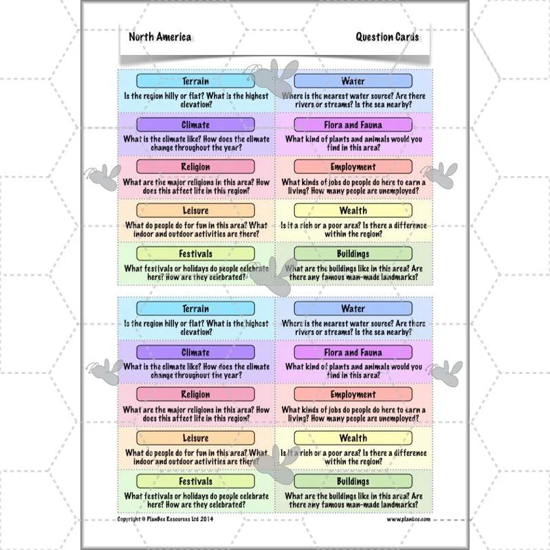
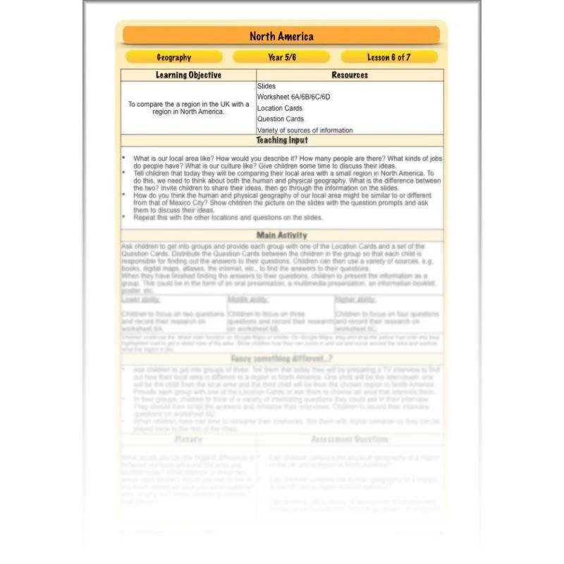
Comparing Locations
This lesson starts by challenging your class to describe, in geographical terms, what their local area is like. They will then compare the human and physical geography of their local area with a specific area of North America. This is a great lesson to challenge their investigative skills and get them thinking about how places vary around the world.
This downloadable lesson contains a lesson plan, slideshow presentation and printable teaching resources in a handy ready-to-teach pack.
What's included:
- Lesson plan
- Slides
- Activity ideas
- Differentiated worksheets
- Location cards
- Question cards
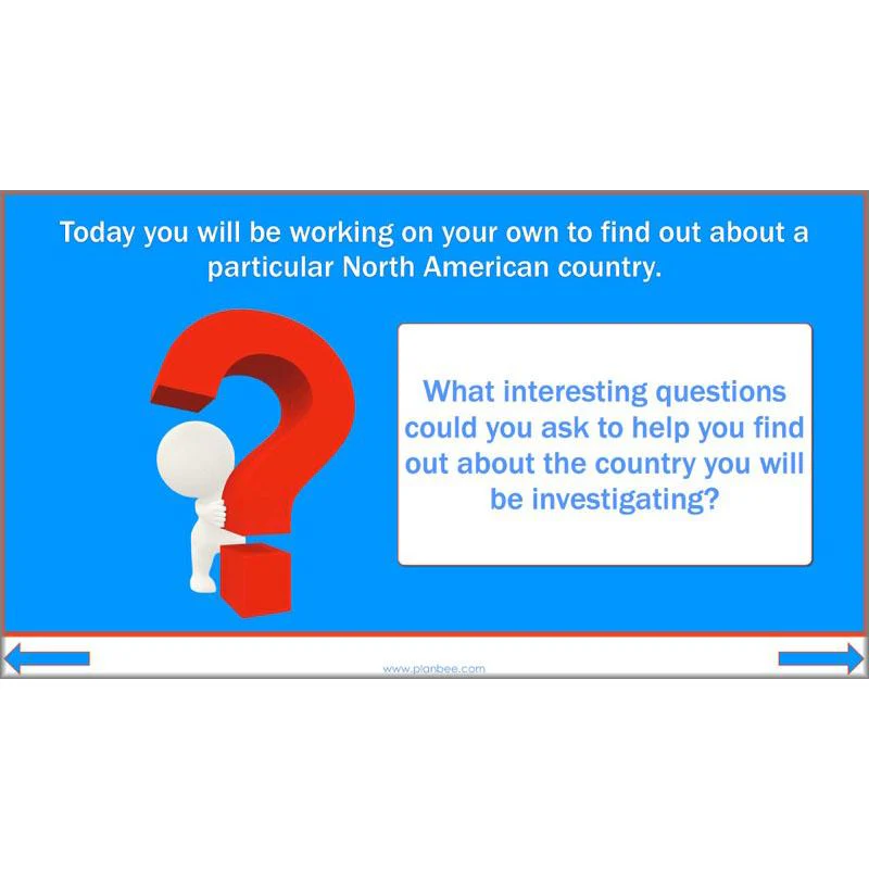
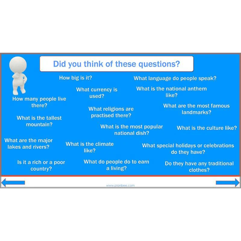
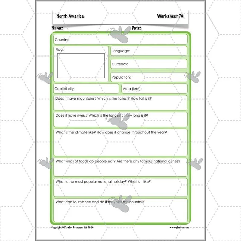
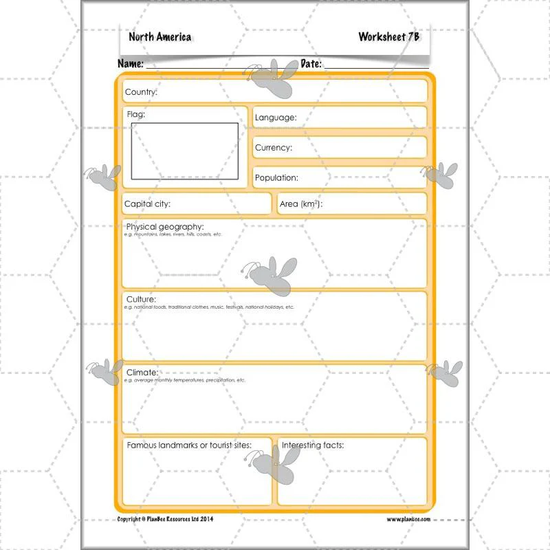
Country Study
The final lesson in this series gives your class the chance to consolidate everything they have learnt about North America by choosing one particular country to research in detail. There is the option to present the information they discover in a variety of ways, giving them the freedom to express their understanding through descriptions, pictures, graphs and more.
This downloadable lesson contains a lesson plan, slideshow presentation and printable teaching resources.
What's included:
- Lesson plan
- Slides
- Activity ideas
- Differentiated worksheets
- Challenge cards
Original: $4.62
-70%$4.62
$1.39Product Information
Product Information
Shipping & Returns
Shipping & Returns
Description
Voyage across the Atlantic with your class as they discover the continent of North America and all its amazing countries, cities and landscapes with this North America KS2 planning pack for Year 5 and Year 6. Your class will identify the 23 countries of North America, from the vast lands of the USA and Canada down through Central America and on to the Caribbean islands. On the way they will explore the various geographical features of different areas of North America and compare them with their own locality.
Including a set of detailed lesson plans, informative slideshows for each lesson, differentiated activity ideas, and a range of colourful, engaging worksheets and other helpful printable resources, this 'North America' KS2 planning pack provide everything you need to teach your class about this fascinating and diverse continent – it's all ready for you to download, teach and enjoy with your Year 5 or Year 6 class.
You may also like our Yosemite National Park Geography scheme of work exploring the one of the oldest national parks in North America.
The Countries
This Countries in North America KS2 lesson is the first lesson in the North America Geography Scheme of work. It starts by helping your children identify North America on a world map before identifying and locating the 23 countries of North America on a map. Your children will discover how North America is split into sections, including Central America and the Caribbean, before using their map skills to label each of the countries on a blank map. Alternatively they can solve some tricky riddles to identify each country!
This downloadable lesson comes with a lesson plan, slideshow presentation and printable teaching resources.
What's included:
- Lesson plan
- Slides
- Activity ideas
- Differentiated worksheets
- Riddle cards
- Flag cards
- North America map
Climates
This Climate of North America lesson starts by identifying some different climate zones. Your class will look at a global climate map before exploring the various climate zones of North America in more detail. They will be challenged to match up various climate graphs to descriptions and pictures of a variety of North American locations, interpreting the graphs to identify which locations are being described. There is also the option to compare the climates of two or more North American locations in more detail.
This downloadable lesson comes with a lesson plan, slideshow presentation and printable teaching resources.
What's included:
- Lesson plan
- Slides
- Activity ideas
- Differentiated puzzle packs
- Answer sheet
- Location cards
- Challenge cards
Features
This interesting Human and Physical Geography of North America lesson gives your KS2 class a whistle-stop tour of some of the most amazing geographical features of North America, both natural and man-made. From the Grand Canyon to the Panama Canal, your class will investigate different features and consider how they came to be there. They can then compile a list of the top North American wonders!
This downloadable lesson contains a lesson plan, slideshow presentation and printable teaching resources.
What's included:
- Lesson plan
- Slides
- Activity ideas
- Differentiated worksheets
- Picture cards
- Information sheet
Capital Cities
After a quick recap of the names of some North American countries, your children will investigate some of their capital cities. They will be challenged to think of questions they could ask to find out information about a particular city, such as the population, climate and language, before either comparing capital cities from the given Fact Cards or choosing one city to investigate for themselves.
This downloadable lesson comes complete with a lesson plan, slideshow presentation and printable teaching resources.
What's included:
- Lesson plan
- Slides
- Activity ideas
- Differentiated worksheets
- Fact cards
- Capital city cards
- Country cards
Time Zones
This fun North America Time Zones KS2 lesson introduces your class to the different time zones of the world. It focuses on North America and challenges your class to think about why we have time zones and what this means for people in different locations around the world. They will then be challenged to work out some time zone problems, such as what the time is in Washington, D.C. if it is 2pm in London.
This downloadable lesson contains a lesson plan. slideshow presentation and printable teaching resources.
What's included:
- Lesson plan
- Slides
- Activity ideas
- Differentiated worksheets
- Differentiated North America time zone maps
- World time zone map
- Character cards
- Time cards
Comparing Locations
This lesson starts by challenging your class to describe, in geographical terms, what their local area is like. They will then compare the human and physical geography of their local area with a specific area of North America. This is a great lesson to challenge their investigative skills and get them thinking about how places vary around the world.
This downloadable lesson contains a lesson plan, slideshow presentation and printable teaching resources in a handy ready-to-teach pack.
What's included:
- Lesson plan
- Slides
- Activity ideas
- Differentiated worksheets
- Location cards
- Question cards
Country Study
The final lesson in this series gives your class the chance to consolidate everything they have learnt about North America by choosing one particular country to research in detail. There is the option to present the information they discover in a variety of ways, giving them the freedom to express their understanding through descriptions, pictures, graphs and more.
This downloadable lesson contains a lesson plan, slideshow presentation and printable teaching resources.
What's included:
- Lesson plan
- Slides
- Activity ideas
- Differentiated worksheets
- Challenge cards